Protect what matters most — your environment, biodiversity, and communities
Oil spill sensitivity mapping is a key element of preparedness and environmental protection. By identifying and prioritising areas most vulnerable to oil spill impacts, it provides the insight needed to plan ahead, protect vital ecosystems, and reduce risk to local communities and economies.
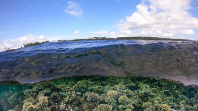
Using detailed spatial and environmental data, our specialists map sensitive shorelines, habitats, and biodiversity hotspots—such as wetlands, mangroves, coral reefs, and estuaries—to highlight where protection and response resources should be focused. These insights underpin effective contingency planning and ensure early, targeted action when incidents occur.
Beyond environmental protection, sensitivity mapping supports smarter, more sustainable decision-making. It helps governments, regulators, and operators plan developments responsibly, implement appropriate safeguards, and meet compliance obligations within Oil Spill Contingency Plans (OSCPs), Oil Pollution Emergency Plans (OPEPs), and Environmental Impact Assessments (EIAs).
By understanding the vulnerability of an area before an incident occurs, organisations can prevent or minimise the effects of a spill while helping to safeguard livelihoods that depend on healthy marine and coastal ecosystems.
At OSRL, our sensitivity mapping services combine scientific expertise with practical experience to deliver actionable insights that strengthen preparedness, inform sustainable operations, and enhance environmental resilience.
Mapping for every stage of response
Different levels of sensitivity mapping provide targeted insights for every stage of preparedness and response. Together, these maps create a complete picture of environmental vulnerability and operational priorities, enabling more effective, informed, and coordinated preparedness across every phase of response.
Strategic Sensitivity Maps
High-level tools that identify areas most at risk from oil spills by combining environmental, ecological, and socio-economic data to guide effective resource allocation.
Tactical Sensitivity Maps
Detailed maps used during response planning to pinpoint sensitive resources and access points, helping teams prioritise and coordinate protective actions.
Operational Sensitivity Maps
Highly detailed, site-specific maps used in real time during spill response to guide containment, cleanup, and protection efforts with precision.

Why OSRL?

FAQs
-
Sensitivity mapping helps governments, industries, and communities make informed decisions about land use, development, and environmental protection. By identifying critical habitats and biodiversity hotspots, it allows for early response planning, reducing harm to wildlife, ecosystems, and local economies dependent on fishing or tourism.
-
Sensitivity maps guide decision-making before and during an oil spill.
They are used to:- Develop contingency and response plans
- Allocate resources effectively
- Identify access points and equipment locations
- Protect sensitive habitats, species, and socio-economic resources
-
There are three levels of sensitivity maps, each designed for different audiences and uses:
- Strategic maps – high-level overview for decision makers (e.g., policy planning)
- Tactical maps – detailed guidance for On-Scene Commanders and Operations Managers
- Operational maps – site-specific information for responders directly at the spill location
-
Sensitive receptors are environmental, biological, and socio-economic resources that are particularly vulnerable to oil pollution. These include:
- Biological resources (birds, marine mammals, sea turtles, fish, coral reefs, mangroves, seagrass)
- Shoreline habitats (estuaries, wetlands, tidal flats, beaches)
- Human uses (fisheries, aquaculture, tourism, drinking water sources)
- Cultural and archaeological sites (heritage and sacred coastal areas)
- Community and public health (coastal populations affected by food security or health risks)
-
OSRL has direct access to UNEP-WCMC’s Proteus Partnership database, enabling access to global environmental data. Whether through member services or pay-as-you-go options, we provide high-quality, tailored maps that support preparedness and response. Our maps can also incorporate seasonal variations and worst-case spill modelling to help clients prepare effectively. It is oil spill sensitivity mapping, developed by oil spill professionals.
-
Sensitivity mapping is valuable for:
- Government agencies developing policies and regulations
- Energy and maritime industries planning offshore operations and response strategies
- Environmental organisations protecting critical ecosystems
- Local communities reliant on healthy ecosystems for livelihoods such as fishing and tourism
-
Our Geospatial team has delivered projects across the globe, including Argentina, Azerbaijan, Bahamas, Mexico, Mozambique, Papua New Guinea, the Philippines, Spain, and Uruguay.
View our surveillance, modelling and visualisation articles

Satellite Imagery: A Valuable Tool For Oil Spill Surveillance and Monitoring

TPR Seminar Series - Part Two: Surveillance, Modelling and Visualisation

ATSEA-2 Webinar Series - Part 2: SMV & Response Strategies

Be ready. Be resilient.
Strengthen your spill response today.
With our preparedness services, you can enhance your capabilities and improve response efficiency. Invest in your preparedness today for the response of tomorrow. Find out more about this service and our range of preparedness solutions.
Simply fill in the form, and we'll get in contact with you.
If you would prefer to call us, pick up the phone to speak with our Preparedness Solutions Advisors and Country Representatives. We look forward to talking with you!
+44 (0)23 8033 1551
Regional numbers:
Asia Pacific
+65 6266 1566
Americas
+1 954 983 9880

